From a biological / limnological perspective, the differences between a LAKE versus a POND are somewhat 'fuzzy'. Nevertheless, ponds are typically smaller & shallower than lakes. For a summary of the differences between lakes and ponds, see this article by Linda Bacon (ME DEP).
However, at least in Maine, the name of a waterbody does not necessarily correlate to its limnological status.
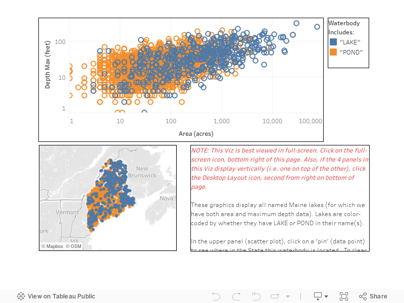
These graphics display all named waterbodies in Maine (for which we have both area and maximum depth data) and indicate which have LAKE or POND in their names. (Some waterbodies have more than one name - sometimes these alternate names contain both words: 'lake' and 'pond'. In this graphic, such waterbodies are included in both categories.)
The scatter plot is a graph of lake areas and maximum depths - note that both axes are logarithmic, so that the data points are 'spread out' for visual clarity. Mouse over a data point to see the lake name, area and depth. Click on a data point to see where in the State that lake is located. (After selecting a lake, simply hit the ESC key to return to the original view.)
Ⓒ LSM / VLMP 2022