
Sandy Stream Pond
Mount Katahdin Twp, Piscataquis, Maine
MIDAS 2040
| Area (acres): | 14 |
| Perimeter (miles): | 0.6 |
| Mean Depth (feet): | 3 |
| Max Depth (feet): | 4 |
| Delorme Page: | 51 |
| Fishery Type: | Coldwater |
| Invasive Aquatic Plant Infestation: | None known |
Other Lake & Watershed Information
Boating & Fishing Regulations for this and other Maine waters are available here.
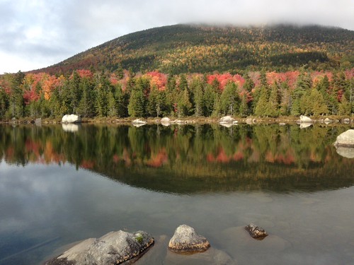
Photo: Sandy Stream - www.amazingfishametric.com


![]() Boat launches
Boat launches
![]() Hills and mountains
Hills and mountains
![]() Nearby lakes
Nearby lakes
NEARBY LAKES
Distance is measured from lake centroid to lake centroid
- Whidden Pond #3 0.48 miles west
- Whidden Pond #1 0.48 miles west
- Whidden Pond #2 0.84 miles northwest
- Depot Pond 1.45 miles west
- Martin Pond #2 1.60 miles east
- Martin Pond #1 1.60 miles east
- Basin Pond (Lower) 1.60 miles southwest
- Pamola Pond 1.60 miles southwest
- Basin Pond (Upper) 2.05 miles west
- Twin Pond #1 2.29 miles northeast
Lake Water Quality Reports
Summaries for most often used measurements to describe the water quality of Sandy Stream Pond.
Sandy Stream Pond
Terms of Use: click here »