
Lower South Branch Pd
T5 R9 WELS, Piscataquis, Maine
MIDAS 4222
| Area (acres): | 108 |
| Perimeter (miles): | 2.2 |
| Mean Depth (feet): | 32 |
| Max Depth (feet): | 60 |
| Delorme Page: | 51 |
| Fishery Type: | Coldwater |
| Invasive Aquatic Plant Infestation: | None known |
Other Lake & Watershed Information
Boating & Fishing Regulations for this and other Maine waters are available here.

general view
Photo: Lower S. Branch Pond - www.amazingfishametric.com
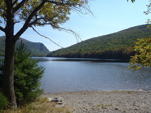
Photo: Lower S. Branch Pond - www.amazingfishametric.com


![]() Boat launches
Boat launches
![]() Hills and mountains
Hills and mountains
![]() Nearby lakes
Nearby lakes
NEARBY LAKES
Distance is measured from lake centroid to lake centroid
- Upper South Branch Pd 0.84 miles southeast
- Lower Fowler Pond 2.83 miles northeast
- Mahar Pond 2.93 miles south
- Middle Fowler Pond 3.20 miles northeast
- Little Fowler Pond 3.64 miles northeast
- Long Pond 3.99 miles northeast
- High Pond 3.99 miles northeast
- Round Pond 4.35 miles northeast
- Billfish Pond 4.73 miles northeast
- Littlefield Pond 4.82 miles northeast
Lower South Branch Pd
Terms of Use: click here »