
Upper South Branch Pd
T5 R9 WELS, Piscataquis, Maine
MIDAS 4224
| Area (acres): | 96 |
| Perimeter (miles): | 1.8 |
| Mean Depth (feet): | 43 |
| Max Depth (feet): | 76 |
| Delorme Page: | 51 |
| Fishery Type: | Coldwater |
| Invasive Aquatic Plant Infestation: | None known |
Other Lake & Watershed Information
Boating & Fishing Regulations for this and other Maine waters are available here.
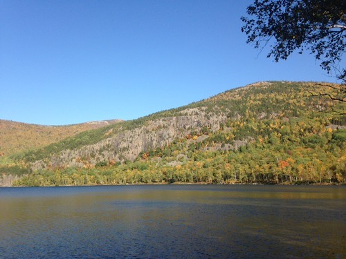
Photo: Upper S. Branch Pond - www.amazingfishametric.com
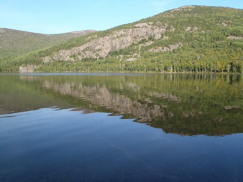
Photo: Upper S. Branch Pond - www.amazingfishametric.com


![]() Boat launches
Boat launches
![]() Hills and mountains
Hills and mountains
![]() Nearby lakes
Nearby lakes
NEARBY LAKES
Distance is measured from lake centroid to lake centroid
- Lower South Branch Pd 0.84 miles northwest
- Mahar Pond 2.52 miles southwest
- Lower Fowler Pond 3.12 miles northeast
- Middle Fowler Pond 3.17 miles northeast
- Little Fowler Pond 3.55 miles northeast
- Traveler Pond 3.99 miles southeast
- Pogy Pond 4.14 miles south
- Weed Pond 4.17 miles south
- Long Pond 4.21 miles northeast
- High Pond 4.21 miles northeast
Lake Water Quality Reports
Summaries for most often used measurements to describe the water quality of Upper South Branch Pd.
Upper South Branch Pd
Terms of Use: click here »