


 Boat launches
 Hills and mountains
 Nearby lakes
NEARBY LAKES
Distance is measured from lake centroid to lake centroid
- Three Corner Pond (5384) 1.99 miles east
- Kerr Pond (5388) 2.30 miles southeast
- Dyer Long Pond (5386) 2.42 miles east
- Weary Pond (5380) 2.55 miles southwest
- Little Dyer Pond (5394) 2.76 miles south
- Travel Pond (5456) 3.14 miles northeast
- Flood Pond (5390) 3.40 miles southeast
- Musquash Pond (5392) 3.76 miles southeast
- Deer Meadow Pond (5396) 5.23 miles southeast
- Givens (Longfellow) Pond (5450) 5.41 miles northwest
- Joices Pond (5376) 5.51 miles west
- Horn Pond (5398) 5.72 miles southeast
Clary (Pleasant) Lake
Jefferson, Whitefield, Lincoln, Maine
MIDAS 5382
| Area (acres): | 674 |
| Perimeter (miles): | 10.9 |
| Mean Depth (feet): | 14 |
| Max Depth (feet): | 30 |
| Delorme Page: | 13 |
| Fishery Type: | Warmwater |
| Invasive Aquatic Plant Infestation: | None known |
Other Lake & Watershed Information

Water Quality
Monitoring Stations
Click the images below to open in new window
Boating & Fishing Regulations for this and other Maine waters are available here.
 Click the printer icon for printable depth map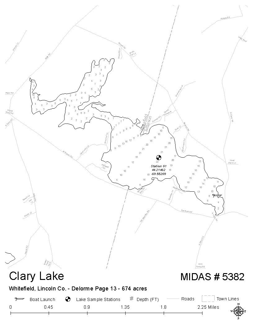


Maine DEP Lake Scorecard 
The Scorecard summarizes many types of lake data into one color-coded graphic, based on current conditions or trends in the lake's health. The color is indicative of an overall condition assessment of each category: blue = good, yellow = fair, and red = poor. Grey indicates there is not enough data for an assessment.
A small number of lakes have more than one hydrologic basin, and there will be scorecards for each basin.
Click the Scorecard image or images below to open the interactive Scorecard and learn more about each of the categories and their respective parameters -- and to get involved!
Questions? Email: [email protected]
To learn more about the scorecard and to have the opportunity to ask the DEP questions, watch this webinar:
Understanding the New Maine DEP Lake Scorecard