
Enchanted Pond
Upper Enchanted Twp, Somerset, Maine
MIDAS 0150
| Area (acres): | 334 |
| Perimeter (miles): | 4.2 |
| Mean Depth (feet): | 70 |
| Max Depth (feet): | 185 |
| Delorme Page: | 39 |
| Fishery Type: | Coldwater |
| Invasive Aquatic Plant Infestation: | None known |
Other Lake & Watershed Information
Boating & Fishing Regulations for this and other Maine waters are available here.
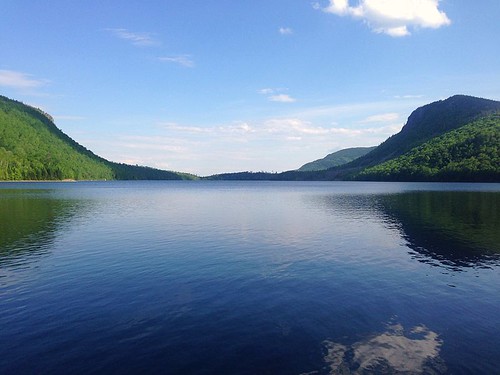
View of Enchanted Pond in June as seen from Bulldog Camps, a sporting camp on the north shore.
Photo: Enchanted Pond from Bulldog Camps - D Savage
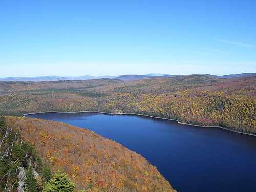
View of the pond in autumn from Enchanted Lookout on Bulldog Peak of Shutdown Mountain, looking north towards Bulldog Camps.
Photo: Enchanted Pond from Enchanted Lookout - D Savage


![]() Boat launches
Boat launches
![]() Hills and mountains
Hills and mountains
![]() Nearby lakes
Nearby lakes
NEARBY LAKES
Distance is measured from lake centroid to lake centroid
- McKenney Pond #1 2.29 miles northwest
- McKenney Pond #2 2.29 miles northwest
- Little Enchanted Pond 2.92 miles west
- Little Gordon Pond 3.12 miles southwest
- Gordon Pond 3.19 miles southwest
- Grace Pond 3.45 miles north
- John's Pond 3.75 miles southeast
- Redmond Pond 4.26 miles south
- Bill Morris Pond 4.52 miles southwest
- Mountain Pond #2 4.85 miles northeast
Lake Water Quality Reports
Summaries for most often used measurements to describe the water quality of Enchanted Pond.
Enchanted Pond
Terms of Use: click here »