
West Harbor Pond
Boothbay Harbor, Lincoln, Maine
MIDAS 5372
| Area (acres): | 80 |
| Perimeter (miles): | 4.2 |
| Mean Depth (feet): | 15 |
| Max Depth (feet): | 34 |
| Delorme Page: | 7 |
| Fishery Type: | Coldwater + Warmwater |
| Invasive Aquatic Plant Infestation: | None known |
Other Lake & Watershed Information
Boating & Fishing Regulations for this and other Maine waters are available here.
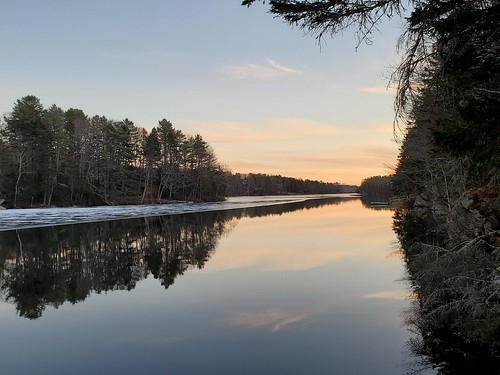
Iceout on West Harbor Pond, January 2021. Photo: Merritt Blakeslee
Photo: West Harbor Pond
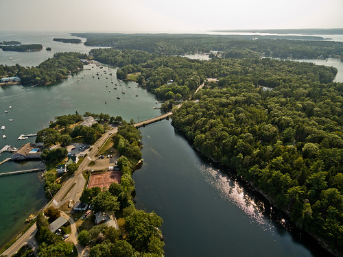
Aerial view of the lower end of West Harbor Pond, the dam carrying the Route 27 causeway, and, in the background, Boothbay Harbor’s inner harbor. Photo courtesy of West Harbor Pond Watershed Association.
Photo: West Harbor Pond


![]() Boat launches
Boat launches
![]() Hills and mountains
Hills and mountains
![]() Nearby lakes
Nearby lakes
NEARBY LAKES
Distance is measured from lake centroid to lake centroid
- Knickerbocker Ponds 1.38 miles north
- Pat's Pond 1.50 miles east
- Sawyers Pond 2.07 miles south
- Appalachie Pond 2.11 miles east
- Adams Pond 2.30 miles northeast
- Wiley Pond 2.81 miles north
- Charles Pond 4.46 miles southwest
- Heal Pond 4.50 miles west
- Clarey's Pond 4.55 miles west
- Ice Pond 5.42 miles southwest
Lake Water Quality Reports
Summaries for most often used measurements to describe the water quality of West Harbor Pond.
West Harbor Pond
Terms of Use: click here »