
Cobbosseecontee Lake
Litchfield, Manchester, Monmouth, West Gardiner, Winthrop, Kennebec, Maine
MIDAS 5236
| Area (acres): | 5516 |
| Perimeter (miles): | 61.8 |
| Mean Depth (feet): | 37 |
| Max Depth (feet): | 100 |
| Delorme Page: | 12 |
| Fishery Type: | Coldwater + Warmwater |
| Invasive Aquatic Plant Infestation: | Eurasian water milfoil (confirmed 2018); European frog-bit (confirmed 2018); Variable-leaf milfoil (confirmed 2020) |
Other Lake & Watershed Information
Maine DEP Lake Scorecard 
The Scorecard summarizes many types of lake data into one color-coded graphic, based on current conditions or trends in the lake's health. The color is indicative of an overall condition assessment of each category: blue = good, yellow = fair, and red = poor. Grey indicates there is not enough data for an assessment.
A small number of lakes have more than one hydrologic basin, and there will be scorecards for each basin.
Click the Scorecard image or images below to open the interactive Scorecard and learn more about each of the categories and their respective parameters -- and to get involved!
Questions? Email: MaineDEPLakeScorecard@Maine.gov

Boating & Fishing Regulations for this and other Maine waters are available here.
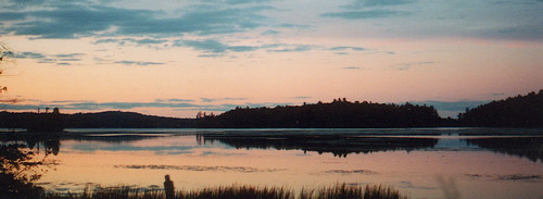
Photo: Cobbossee - L Minkowsky
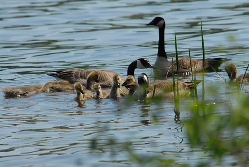
Photo: Cobbossee Lake geese - J Petroulis


![]() Boat launches
Boat launches
![]() Hills and mountains
Hills and mountains
![]() Nearby lakes
Nearby lakes
NEARBY LAKES
Distance is measured from lake centroid to lake centroid
- Lily Pond 0.99 miles east
- Lower Narrows Pond 1.70 miles northwest
- Annabessacook Lake 2.48 miles west
- Upper Narrows Pond 2.81 miles north
- Little Jimmie Pond 2.98 miles east
- Hutchinson (Hudson, Sanborn) Pond 3.06 miles east
- Kezar Pond 3.49 miles north
- Jamies (Jimmie) Pond 3.54 miles east
- Bog Pond 3.63 miles northeast
- Little Purgatory Pond 4.26 miles south
Cobbosseecontee Lake
Terms of Use: click here »